01
Satellite imagery
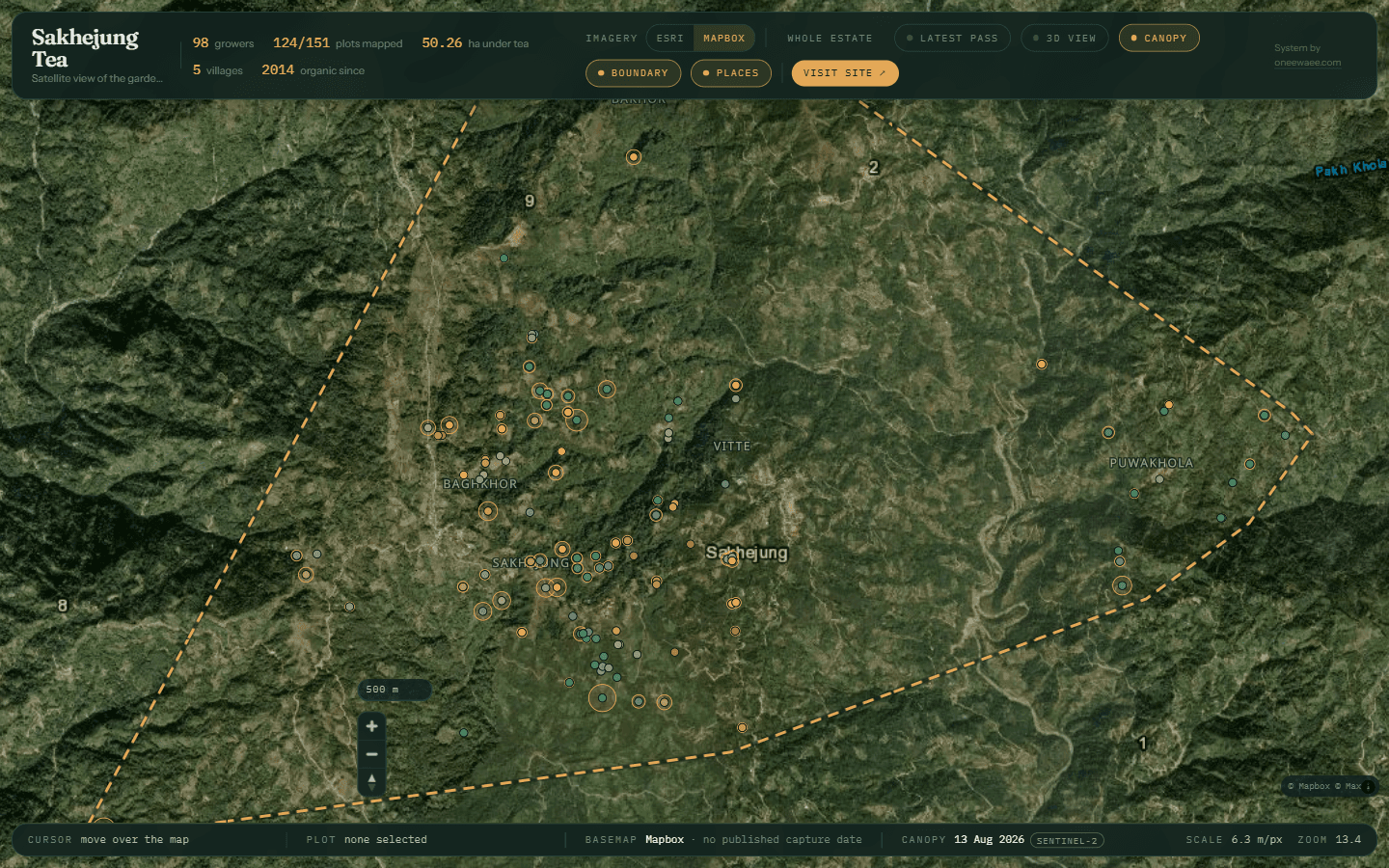
The live map offers imagery options including Esri and Mapbox. Users can inspect the landscape while keeping the source and available capture information in view.
- Switchable imagery sources
- Pan and zoom estate exploration
- Imagery source information
- Scale and zoom context